|
Still here on Great Barrier Island! Good to be here, literally, ‘cause we almost weren’t. At 8:28 am on Friday, 5 March a magnitude 8.1 earthquake struck in the Kermadec Trench off the Kermadec Islands, about 880 km north of New Zealand, not long after two other lesser quakes. The depth of 20-24 km below the seafloor is considered shallow, with the potential for greater damage and a larger tsunami than a deep quake. The quake was reported straightaway on the radio, and people in Northland were told to evacuate. “Whew!” we thought, “We’ll be OK here.” edit. 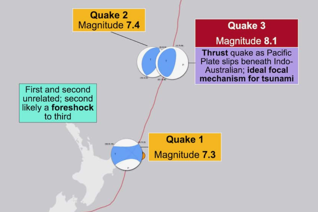 But then, about 20 minutes later, our guts tightened at the scream of sirens blasting by on the road, and on the radio the incessant steely command “EVACUATE NOW! LEAVE IMMEDIATELY!” 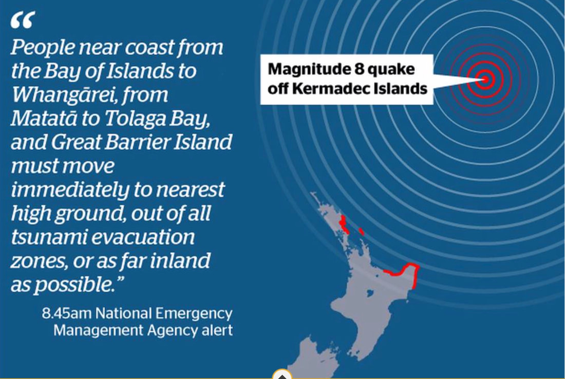 I fell into a daze, trying to adjust to the abrupt change in reality from one moment to the next, holding my “grab & go” list, wondering what the priorities were and getting some things together. Ro kept his wits about him and carried a lot of stuff out and into the car, though his heart rate went way up. I clung to the groundless notion that all would be well that ended well. If you have to evacuate, it was the most beautiful day for it, and a perfect time of day as well! It would have been very difficult in the middle of the night, or bad weather, or both. It happened that we had our brekkie smoothie ready early, because we had another plan for that morning, so we brought it with us! Everyone living where their dwellings could be demolished went to one of the four highest hills along the roads south, central and north. 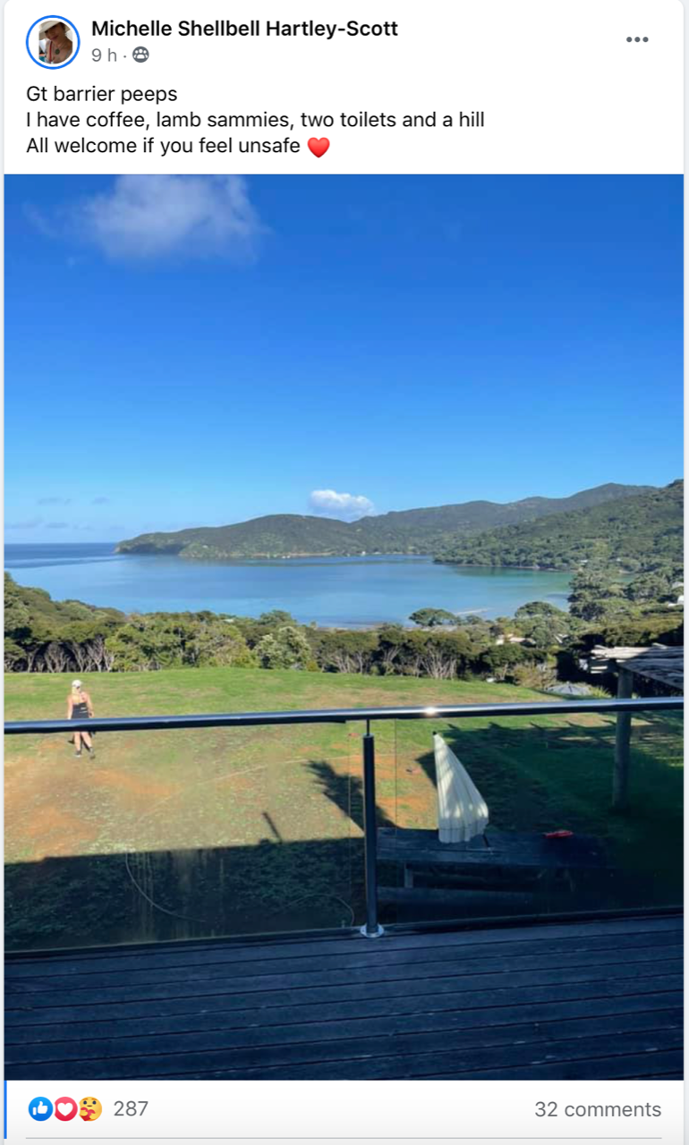 We went to the top of Blind Bay Road, where we had a clear view of the ocean. There we and others hung out, watching. After about two hours we learned it wouldn’t be a big wave but surges with inundation. We stayed another hour as the idea took increasing hold that, really, we'd be OK at home, and we left. So we weren’t very late for lunch either! Perhaps an hour later the all clear was given, and we even got our swim in much later in the day, though it wasn’t advised. The event was stressful, no doubt of that. For four hours, two polar opposite scenarios were in our minds – returning to the house as we left it, having lost just three hours of the day, or seeing a tsunami pull the water out and watch it come screaming in, covering the dunes and lowlands, coming up Oceanview Road and losing our house and everything in and around it.  Pitokuku blocked the view of our house, but we would have known by what happened around it. I wondered if I’d be writing about the tsunami-that-wasn’t for my blog, or if our lives would change so much that I’d never write a blog post again. it was a day just like this, and we were up on Okupu Ridge on Te Ahumata (background(, with Pitokuku below us and the sea beyond. 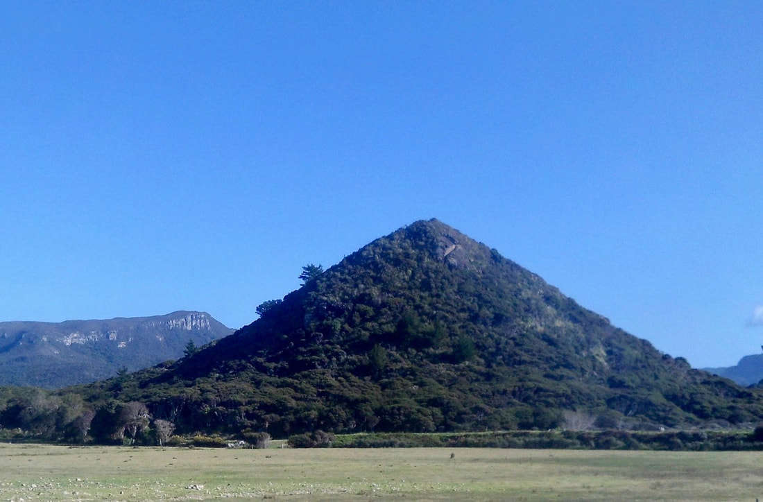 It was a huge relief to see everything as it should be, but I felt drained, shaky and unfocused, and it took the rest of the day and a few more to fully recover. I still think about the possibility of a tsunami more often than before. Ro and I know that we carry the trauma of the devastating debris flow flood of 2011 in Pohara Valley, and that we have a much lower threshold for coping with situations beyond our control. A friend who lives in North Barrier, boat access only, sent this account: Tsunami morning we got all our boats up on the bank and safe, and then shifted our firewood which was in possible danger of being washed away. 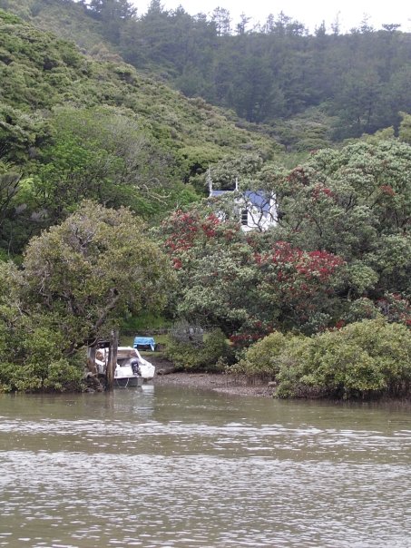 "We had strong surges up the river," she continued. "I could hear the water rushing in and out from up in the garden. The biggest surge was about 1.2 metres, measuring against our jetty piles. The water came over the grass below our house, but not much and only once. The house is about 25 metres above the river so no danger to us. Certainly could have been a major event and very scary."  Here’s why we didn’t all get wiped off the face of the Earth: In the sort of quake it was, called a thrust quake, pent-up stress along the boundary of two tectonic plates is released by a slip of one plate under the other that shakes the sea floor vertically and lifts the water with tremendous force. Every increase of 1 on the magnitude scale is a tenfold jump in shaking. Large tsunamis almost always come from mag 9s, but very large tsunamis can also come from mags in the 7s or 8s, depending on factors beyond the initial depth measurement. That’s why tsunami warnings are standard practice beginning at mag 7, and that was the situation on 5 March. Other factors are the depth of the biggest slip along the fault line and the speed at which stress is released. The deeper the slip along the fault, the less movement and the less water displaced. In our case the biggest slip was close to the surface, and as for speed, the fault rupture was released slowly. Slow is relative, of course — a slow earthquake is 1.5-2 km per second! Fast ones can be double that. The problem with issuing warnings immediately is that scientists can’t know these other factors – the depth of the biggest slip and the speed of the quake – until 15 or 30 minutes later. By the time the rest of us find out, everyone has fled, perhaps unnecessarily, but in this situation, one can’t be too careful! About earthquake depth Shallow quakes are more dangerous because the seismic waves from deep quakes have to travel farther to the surface of the seafloor or land, losing energy along the way. Up to 70 km (the depth of the Earth’s crust) is considered shallow, 70-300 km (the Earth’s upper mantle) is intermediate, and beyond that, to the deepest depth ever recorded, nearly 800 km in the lower mantle, is, clearly, deep. - - - - - - - - - An email from Lotte, a coordinator of Oruawharo Medlands EcoVision “You might have seen me sneaking around the back of your property again last week, setting and collecting our quarterly rat monitoring in the reserve. I thought you might like to see what I found in the tracking tunnel right behind your house.” 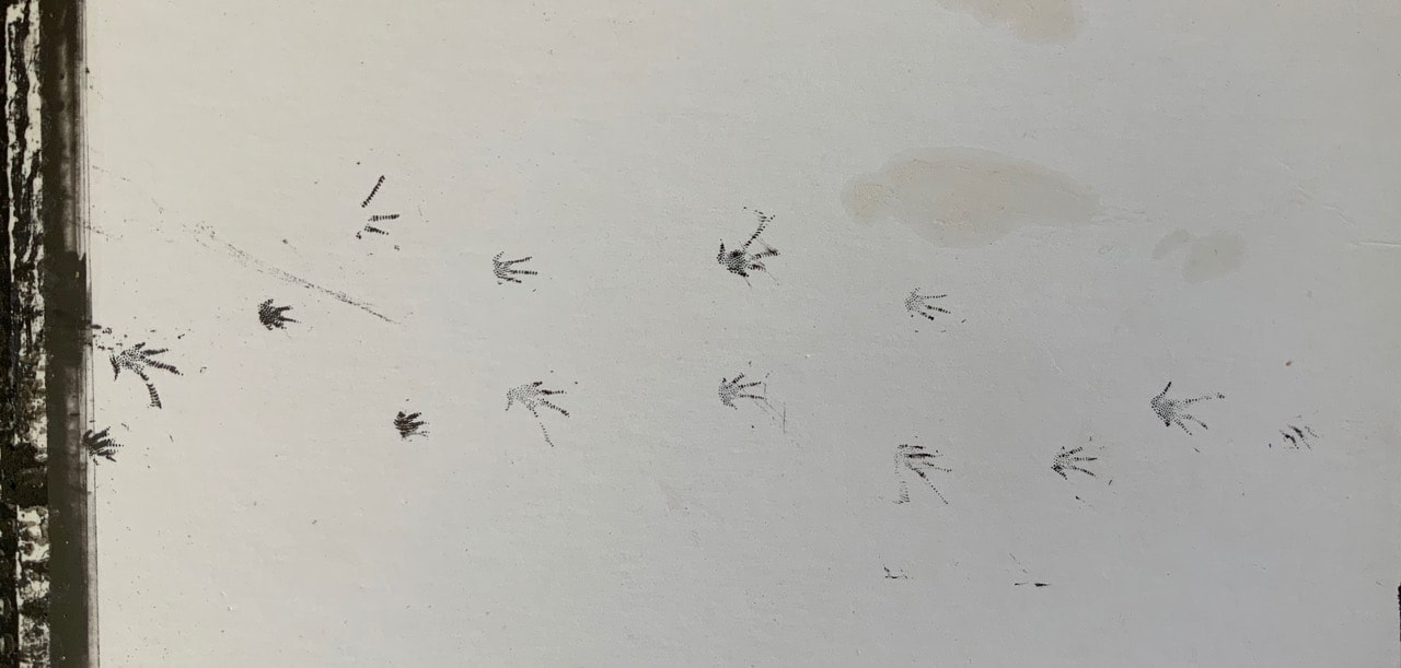 “A beautiful skink had wandered through!" she wrote. "I found skink prints in four out of ten tracking tunnels this time around, so there must be a decent population in Kaitoke. I’m fairly confident it is a moko skink. Note the long bendy hind foot ‘index toe’ visible also in the footprints on the monitoring card.” 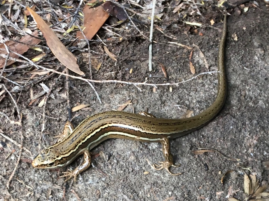 About moko skinks…. They’re mainly found on islands off the east coast of the northern half of the North Island – that’s us! Their colour and pattern vary, but their overall colour is coppery or, like this one, olive brown, and they usually have a dark brown stripe along the side, bordered cream or white on the top and bottom. They have distinctive long toes and tail and grow to a maximum of 18 cm. Moko skinks are active mainly by day, often seen basking or found under logs and stones, in clay banks or up manuka trees! They eat small insects, spiders and other invertebrates. Like most native skinks, they don’t lay eggs but give birth to live young, with litters of up to eight, born around February. Of the three major groups of reptiles – crocodiles, lepidosaurs (snakes and lizards), and turtles, live birth is only seen in lepidosaurs. Even among them, most lay eggs that hatch into young, but a few lizards and snakes, like the moko skink, give birth to live young. Back to Lotte and Oruawharo Medlands EcoVision (OME) She’s a tireless leader of a determined group of mostly volunteers working on area-wide ecological restoration. They receive funding to work toward their goal of protecting and enhancing local biodiversity and ecosystems, including the beach, sand dunes, waterways, wetlands and gardens. One of their main activities, a common tale throughout New Zealand, is suppressing rodent numbers to reduce predation of vulnerable species. Many Barrier people set traps around their own dwellings, and every trapped rat and cat is tallied in the Trap NZ database! 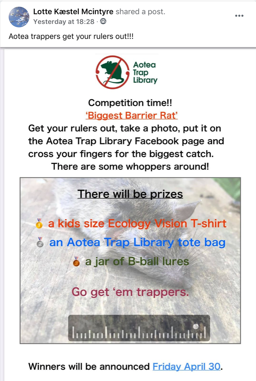 The OME also collaborates with DOC on restoration work at the ecologically significant sites of Oruawharo Stream at the south end of Medlands Beach ... 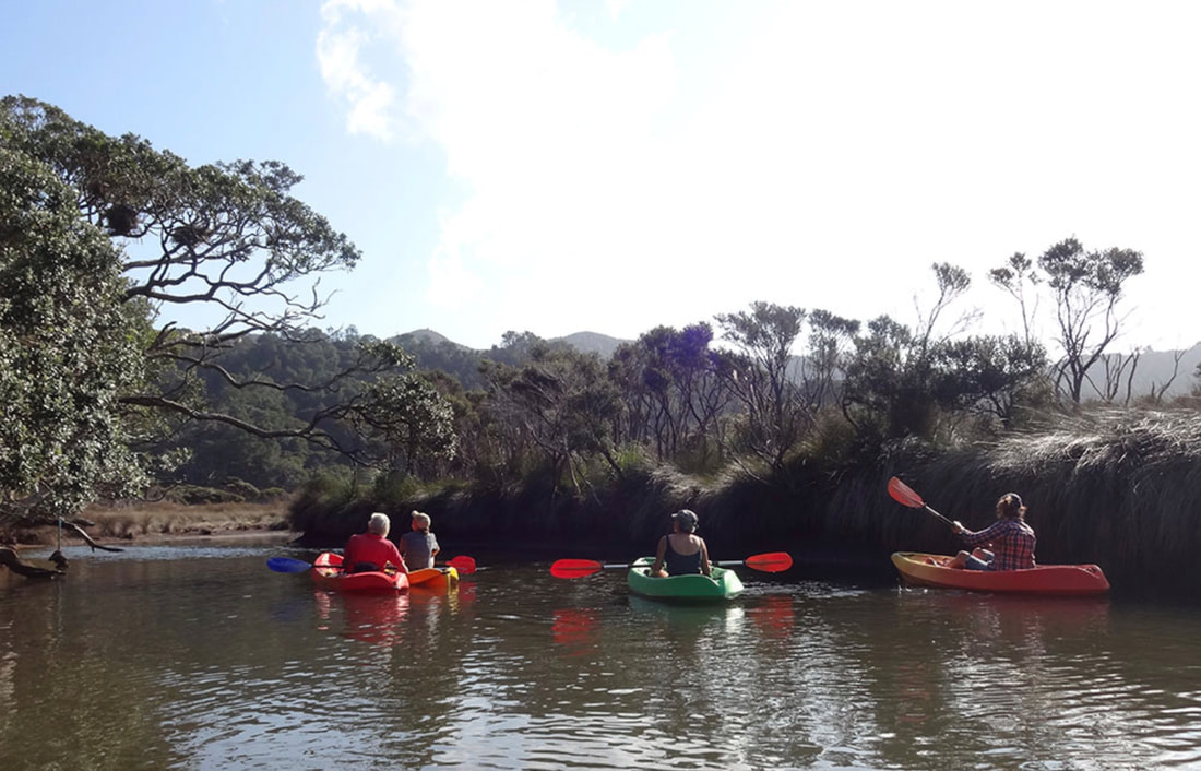 … and the wetlands reserve behind the northern end. They’re replanting, suppressing weeds, monitoring water quality and trap, trap, trapping. The causeway along the wetlands on the main road from Medlands to Sugarloaf is one of only a few straightaways on the island. 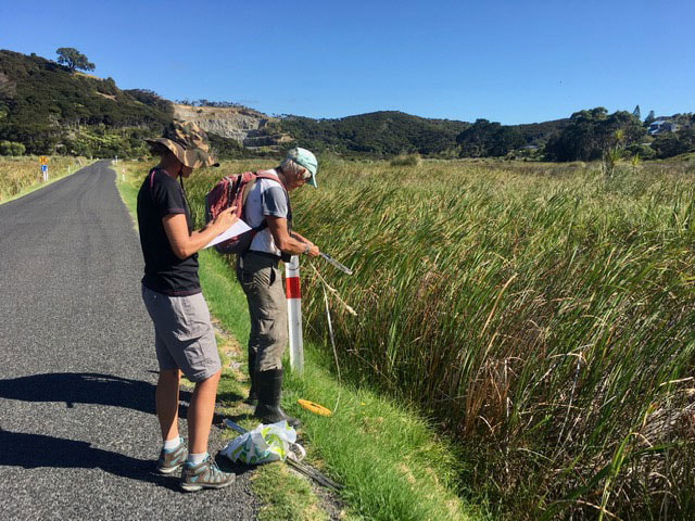 The OME has the support of Ecology Vision Aotea, another relatively new group that umbrellas many community initiatives to protect, restore and enhance the diversity and abundance of the island’s ecosystems “from ridge to reef”. Ecology Vision’s packed-full website is worth a visit to find out about their many projects, including native plant nurseries, a “library” of traps and peanut butter bait, an annual community bird count, and support for individuals and community groups like OME who are carrying out conservation in their home areas. In “Treasures/Taonga” under the “Ecology Vision” tab you’ll find photos and info about Aotea’s birdlife, freshwater fish and lizards, bats and invertebrates. https://ecologyvision.co.nz Conservation is HOT on GBI right now, with new projects and visions large and small, for land and sea, getting underway up and down the island, and a “Pestival" happening this weekend. 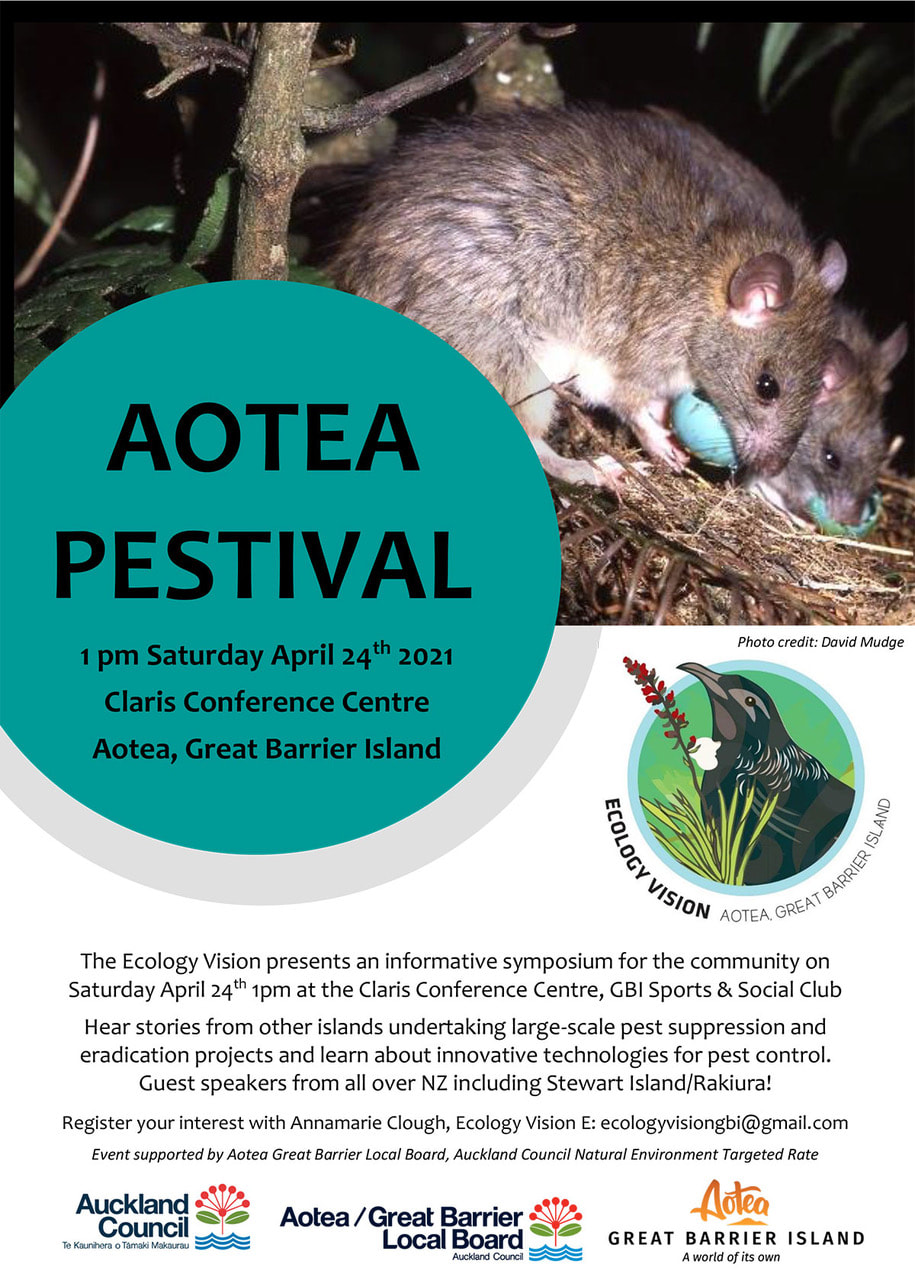 More on that next time! Not to neglect Great Barrier’s absolute gem of a little brother Te-Hauturu-o-Toi, Little Barrier Island, an extinct volcanic cone that last erupted 1.2 million years ago, is about halfway between Great Barrier and the mainland. 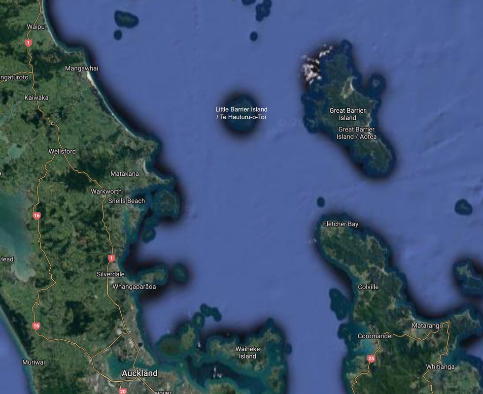 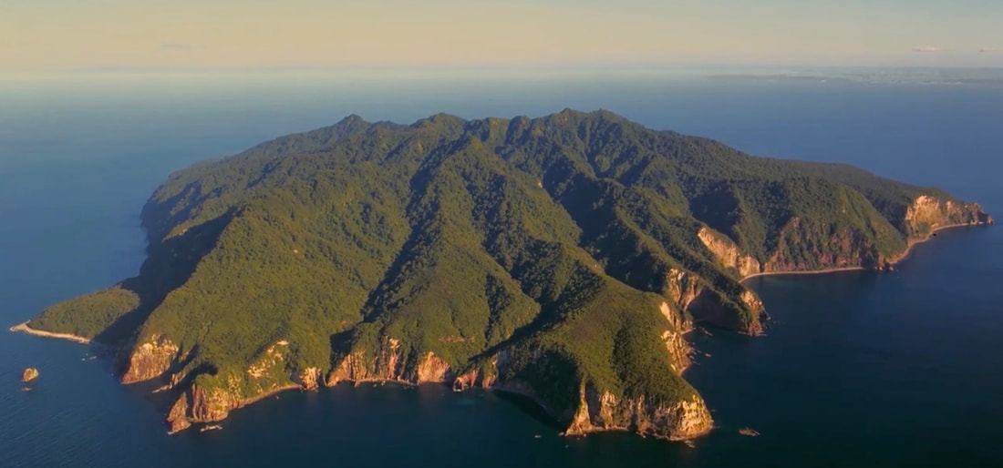 It’s little all right – 28 sq km, or just one-tenth the size of big brother Barrier’s 285 sq km. This ecological treasure became New Zealand’s first nature reserve in 1895, though it was a devastating loss to those who were living there, and were removed, and their kaitiakitanga (guardianship of the island) taken from them. Little Barrier is New Zealand's only large forested area that very few introduced browsing mammals ever set foot on, so it’s a unique remnant of primeval bush and a refuge for rare and endangered plants, birds and animals. Even humans, a highly invasive species, are barred entry without a permit. 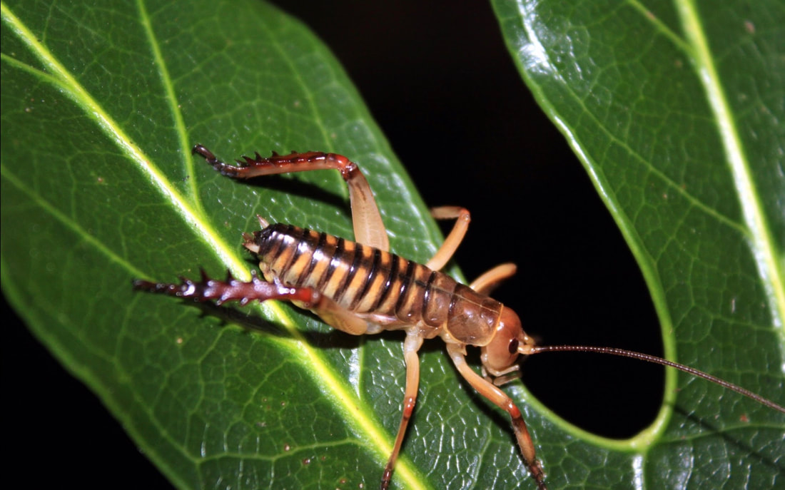 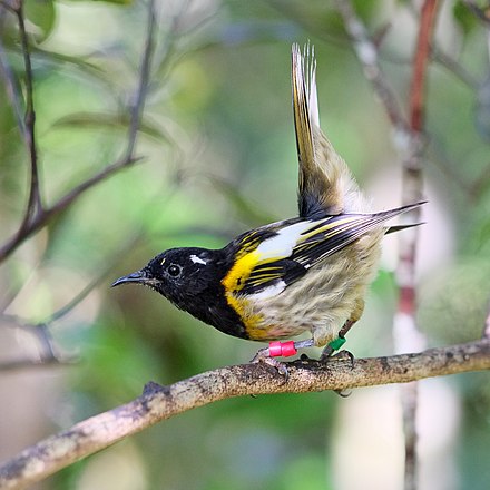 Little Barrier’s highest point is at 700 m, higher than Hirakimata on Great Barrier. Moist rising air often gathers in a fog near the top, creating a cloud forest ecosystem. 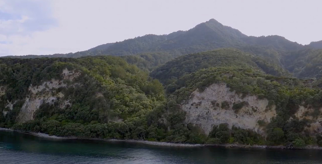 Four hundred native plant species live on Little Barrier, including some now seldom seen on the mainland, and the island is home to the most diversity of native fauna of any island in the country. Because of this, and the fact that it’s free of most introduced predators, Little Barrier Island is considered one of the most important reserves of its kind in the world. 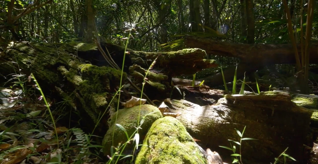 All is not well, however. The island's vegetation is threatened by weed species that continue to invade. Many exotic species have been eradicated, but some are widespread, including the dread pampas and climbing asparagus we knew from Golden Bay. Ongoing monitoring and removal is difficult but essential. Ideally natural processes will in time restore a diverse self-sustaining forest system with large numbers of native lizards and skinks, insects, burrowing seabirds such as black petrels, and threatened birds such as kōkako and saddleback. Many other less rare birds are currently thriving on Little Barrier. All of these photos were taken on Little Barrier. Kākāpō – Its Māori name means “night parrot”, and like the kiwi, it’s a nocturnal bird. 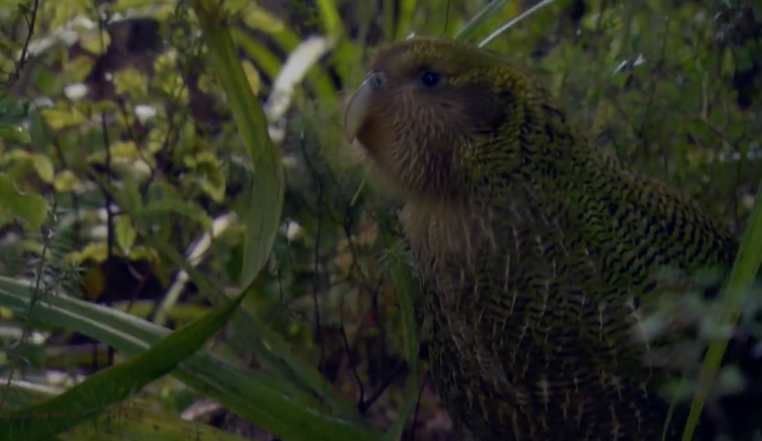 Kōkako 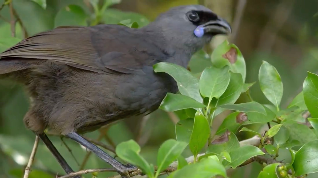 Kākāriki 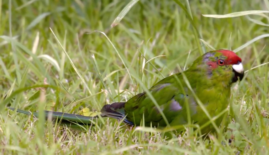 Kiwi 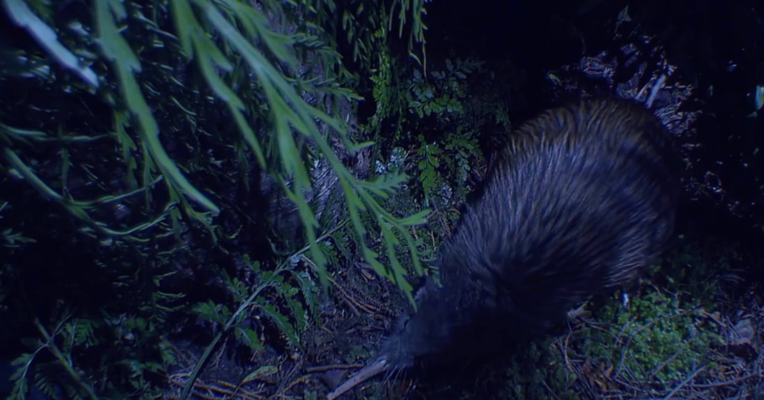 Kōtare (kingfisher) 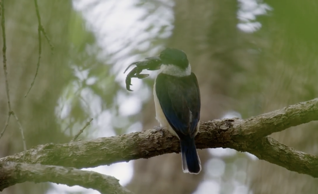 Miromiro (NZ tomtit)  Tieke (saddleback)  Tītī (Cook’s petrel)   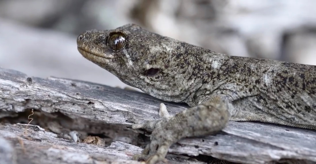 Tuatara 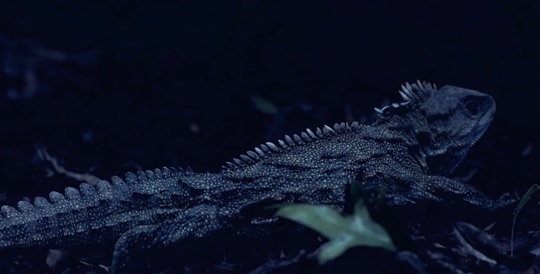 Giant centipede 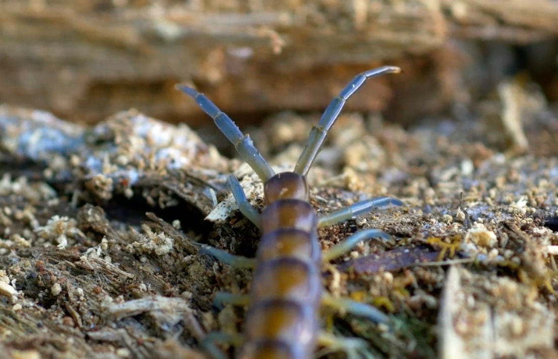  Watch this video and be amazed at what New Zealand once was and still could be! https://www.youtube.com/watch?v=_oNir75_l4U I posted it on Barrier Chitchat and people were thrilled to see it. Like me, most had no idea of the incredible biodiversity so close to us! It’s the perfect time for Barrierites to be extra-inspired because of the current momentum for serious island-wide ecological protection, restoration and enhancement. Little Barrier's Maori name, Te Hauturu-o-Toi, can be interpreted as the "wind's resting post”. Seen from a distance, the cloud cap that often rests at the top of the island creates this impression.  - - - - - - - - - Fruit fest Gerald and Caity’s fruit trees went bananas this autumn! After the season wound down from their height-of-summer mixed boxes of whatever they were harvesting, mainly veges, for the first time they offered order-your-own-choices from a list Caity sent around twice a week. Their fruit trees are prized heirlooms, like Sir Prize, Winter Banana and Dayton apples, planted by Gerald’s father, who started their market garden in Okiwi, North Barrier, decades ago. 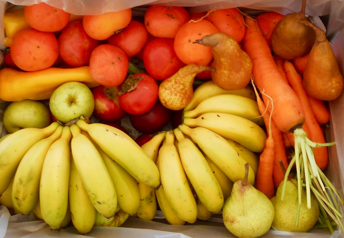 Have you had so-called, and misleadingly called, “astringent” persimmons – the ones in the back? Once fully, transparently, gushy-soft ripe, they’re as sweet, glop-syrupy and luscious as any fruit I’ve ever blissfully slobbered over! This bunch of bananas nearly maxed out Gerald and Caity’s 30-kg scale. 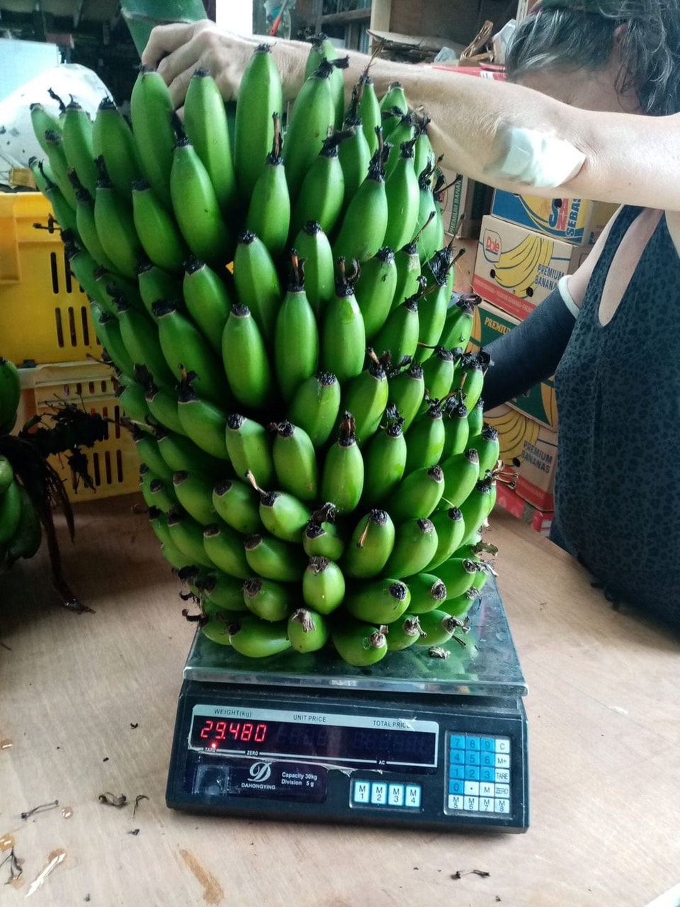 P*ss on it That’s one basil plant on the left, and a tulsi on the right. 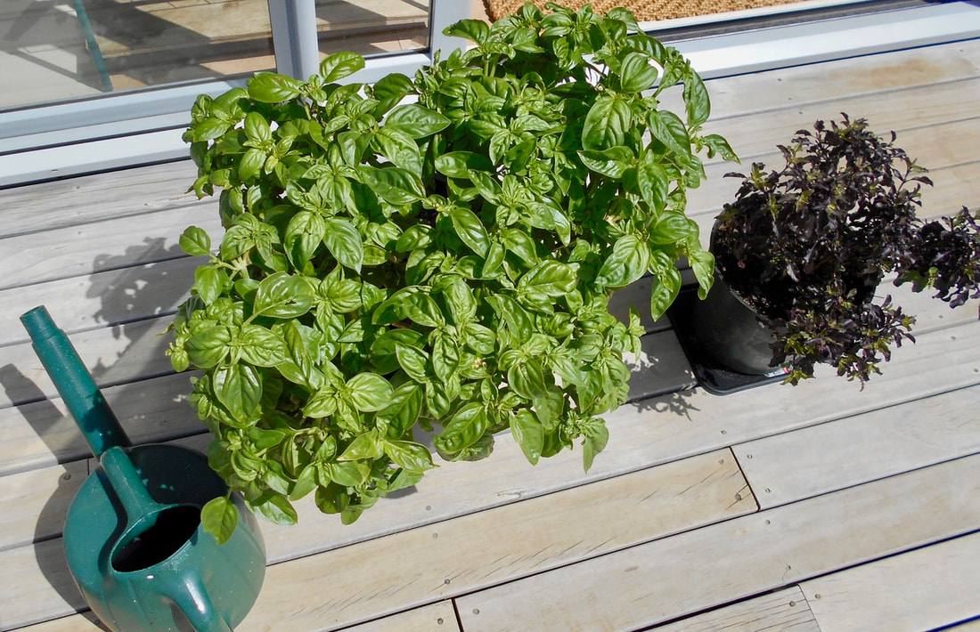 Ro’s technique: Start a brew of seaweed tea with a couple of big pieces of seaweed in a bucket of water. Let sit at least overnight, keep the seaweed in and as you use it over time, top up with water and add more seaweed. Fill watering can ¼ full with the seaweed tea, pee in it once ♂ (or one pee’s worth of pee ♀), fill with water and use on plants. He uses this mix on the garden veges, with regular watering as well, and nothing but this mix on the basil and tulsi, two or three times a day, and never lets them dry out. Lots of gardeners and growers are cottoning on to their own pee – a free, year-round, handy daily source of nitrogen, phosphorous, potassium and trace elements that you can’t buy at a garden shop or order online! - - - - - - - - Summer flowers blooming in autumn! Jordan gave us dahlia bulbs long ago and they didn’t blossom all summer in the drought. When we finally got some real, honest-to-goodness rain, out they came! 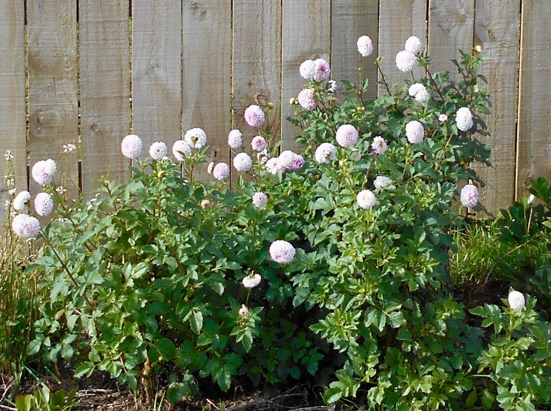
0 Comments
Your comment will be posted after it is approved.
Leave a Reply. |
Great Barrier Island What am I doing here?
