|
Let's enjoy it while we can on GBI! Though the water’s warmer, swimming’s become a bit more challenging – mentally, that is. First we kept seeing a ray at Blind Bay, who’s apparently taken up residence there. We think it’s a harmless, actually gentle, manta ray, but we try not to get close enough to get a better look. 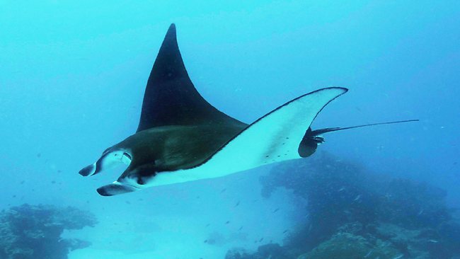 Then a plague of lion’s mane jellyfish in Auckland’s North Shore was reported on the news, and some of them found their way over here. They were mostly on the Gulf side of the island but we’ve seen a few on the beach at Medlands, where we usually swim. 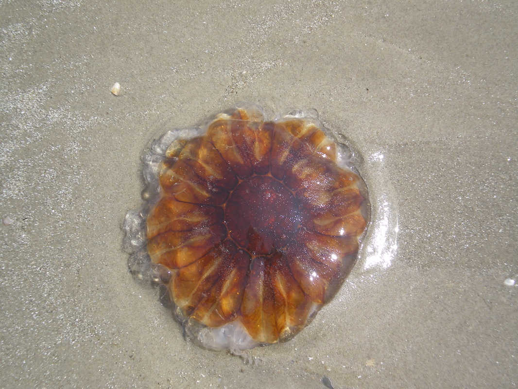 With rays and jellyfish keeping us on alert in the water, this turned up on the Barrier Chitchat facebook page: "Heads up – a couple of 2.5-3 metre bronze whalers cruising inner Mulberry Beach this morning. They look hungry.” I soon learned that bronze whaler is another name for copper shark, one of the few species of sharks that attack humans – though just a tiny percent of the attacks by great white sharks, and only in the presence of their preferred food, which is a range of molluscs and fish, but not usually marine (or other) mammals. 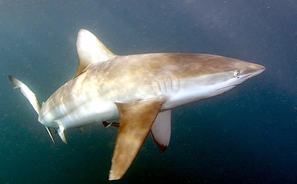 Someone said, Oh, no doubt they’re around all the time and no one knows or cares. At first that seemed comforting but on second thought it wasn’t! Swimming carries on, though I can’t help checking underwater for jellyfish that may be coming my way. Puts a damper on swimming on my back, though, and without my glasses, I have to rely on Ro to look out for sharks! Supermoon, Superquake Last night the full moon was the closest to Earth since 1948. We were completely socked in by clouds here so we couldn’t see it at all, but we'd taken this photo the night before. 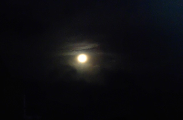 Though we're told the close supermoon appears 14 percent wider and 30 percent brighter than the furthest moon, with no points of reference around it, it was hard to tell the difference. Golden Bay friends, who on the night before the supermoon endured a sleepless night of rolling and shaking, well know that two minutes past midnight a disastrous earthquake followed by aftershocks struck in upper South Island, north of Christchurch where a series of major quakes five years ago killed 180 people, severely damaged the city and caused huge changes and stresses in many peoples’ lives. Though this week’s big South Island quakes damaged buildings in Wellington as well, we were unaware of it this far north until we put the radio on in the morning. Kaikoura took the big hit this time, and the damage and suffering there are great. Disasters on my mind We have our own Golden Bay disaster story. What blissful oblivion we enjoyed for more than a decade there, resting happily in the reassurance that we’d chosen a “lucky” region, blessed with a low risk of any sort of natural disaster. I developed this soothing idea in one of our early years, during Brian Weston’s permaculture correspondence course (though he lived about 1 km away!), for which I gathered information about hazards in our location. Farewell Spit would block tsunamis (how I loved that Spit – it also made the sea just that much calmer for swimming!), cyclones were infrequent visitors, no volcanoes nearby. Ahhh, how comforting it all was! Until BOOM, along came 14 December 2011, when three days of torrential rain triggered a debris flow flood surging down tonnes of soil from steep hill farming and, worst of all, logs, some humungous, left on the forestry slopes above, in violation of the voluntary(!) industry code of compliance, and wiped a third of our place off the face of the earth. Here are before and after photos of the same part of our land. 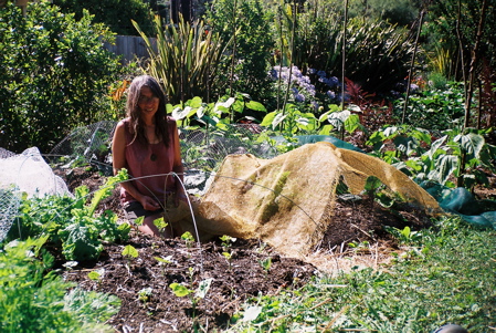 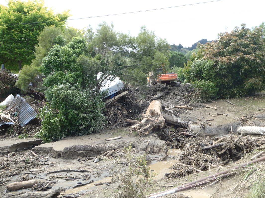 What’s this got to do with Great Barrier Island? For one, it's one reason we left Golden Bay and came here. An email exchange with Bing following one of my updates prompted me to dig a bit deeper into the origin of the island and the hazards here. Here’s what I found out. Great Barrier Island, one source tells me, was formed at the end of the last ice age when volcanic activity caused sea levels to rise. The higher land separated from what's now the Coromandel Peninsula, becoming an island. Another source says that Great Barrier was formed during a period of volcanic eruptions between 18 and 11 million years ago. That’s much earlier than the end of the last ice age! So someone has it wrong! Whenever it was, geology buffs would know that this sort of landscape was formed by volcanoes. 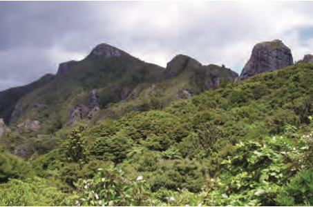 Geologists among you may also like to know that the oldest rocks are sedimentary greywackes and argillites best seen in the extreme north, while over these lie at least two series of volcanic rocks. Market gardeners Gerald and Caity of Okiwi Passion can attest that soil near the estuaries is incredibly fertile. Their eight acres border the vast Whangapoua estuary, which you can see a few fingers of in this photo. 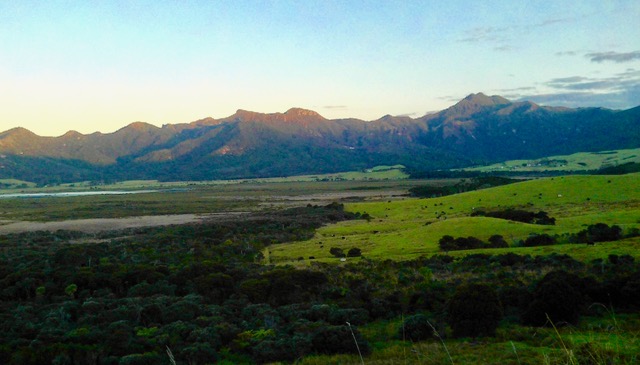 This stream borders their property on its way to the estuary and the sea. We’ve enjoyed the deep swimhole on our visits there. 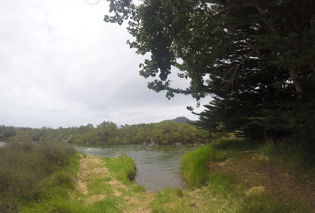 Sea cliffs dominate the northwest and southwest coasts of the island, and small islands and groups of rocks are scattered along the coast. Looking across over Port Fitzroy harbour in the northwest to Little Barrier Island. 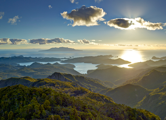  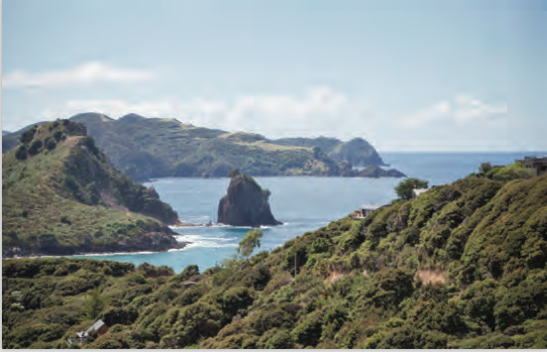 That’s all fine and lovely, but as for the hazards, yikes! The local board's 56-page Hazard Report details the entire “hazardscape": severe weather, droughts, wildfires, flooding from rainfall and rivers, coastal inundation, tsunamis, land instability, landslides, coastal erosion, earthquakes and volcanic ashfall! OMG! Of course, I tell myself, none of these things may ever happen – though many already have. Cyclones, thunderstorms, tornados and drought are far from unknown here. We’ve seen major slips and other damage from a cyclone in North Barrier the winter before we arrived. It’s believed to be the biggest storm to hit the island in living memory, and its impact was certainly the worst people could remember. The main road was closed – blocked by slips and washed-away bridges, campsites and huts were out of action, and some of the tracks were just recently reopened. 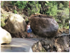 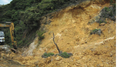 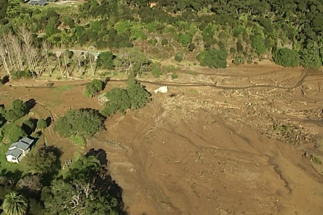 Just like the Golden Bay disaster in 2011, when people in other parts of the Bay had little idea of what the east side was experiencing, those further south on the Barrier didn’t really grasp the severity of the 2014 event. Wildfire threatens as well. Coastal winds, large areas of super-flammable regenerating scrub and limited access increase the risk. In summer 2013, a wildfire burned 116 hectares of scrub and grassland near the airport. The poor people who caused the frightful and potentially devastating debacle had somehow set it off from an LPG barbie. This is a photo of that fire. 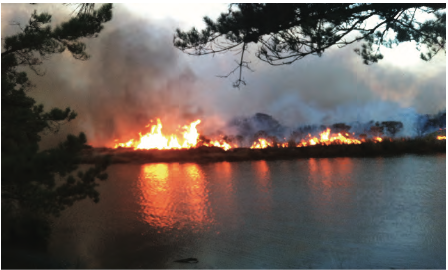 At the other end of the hazardscape, flooding is the most frequent natural hazard, especially in the low-lying plains: from Claris and Kaitoke (where we are) to Medlands Beach, Awana Valley a bit to the north, and Whangapoua Beach in North Barrier. This looks like a lake, but it’s the Medlands causeway along the main road under water after heavy rain. 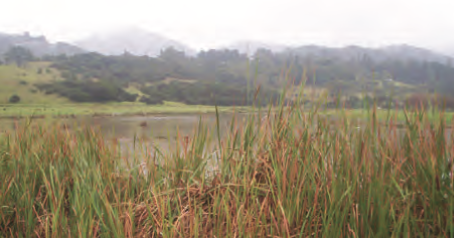 Another vulnerable stretch of the main road is north of Awana. Both this and the Medlands causeway have flooded more than once since we’ve been here. 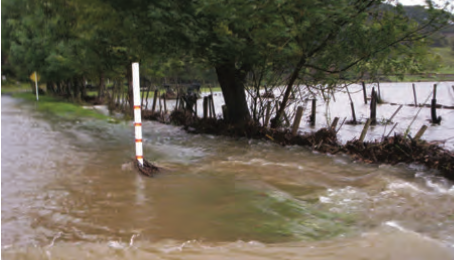 The entire island’s diverse terrain means that floods are unpredictable, variable and dynamic. A cup of chamomile tea sounds good right now! From the West Coast Times, 1907 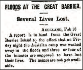 Flood prone areas near the coast are, of course, also vulnerable to tsunamis. This very old aerial photo of Kaitoke Beach (a very wide beach, so the water isn’t in the photo) and Oceanview Road shows our hopeless position (fifth on the left, starting from the beach) if one of those monstrous waves comes galloping across the Pacific Ocean and meets – a Barrier!! 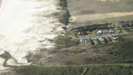 I’ll conclude this jolly discussion with the euphemistically named “maritime incidents”: 50 shipwrecks off the coast of Great Barrier in the last 160 years. New Zealanders will know of the 1894 wreck of the SS Wairarapa. The passenger ship struck rocks at the northern tip of the island just after midnight en route to Auckland from Sydney. The captain wasn’t worthy of the title. He was going too fast, in the dark, in fog, in rough seas, on the wrong course, ignoring currents. 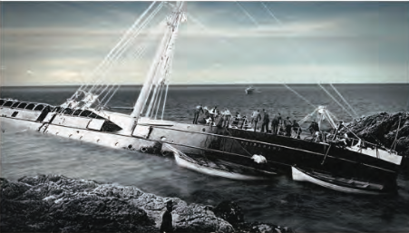 -If, like me, you wonder how this photo could have been taken at that time in those conditions, it wasn’t! It was part of the TV series Descent from Disaster, which aired on TV1 several years ago. Local Board sworn in Back to the here and now on a calm and pleasant day. Our local board chair, Izzy Fordham, seems as popular as Golden Bay’s dear, beloved Joe Bell. Virtually everyone who voted last month chose her for a third term, along with choosing four others out of a total of eight candidates. The Barrier’s voter turnout of 72 percent was nearly double that of Auckland’s abysmal average of 39 percent. I recall that Golden Bay turnout was always at the top end, maybe even better than 72. Perhaps people in smaller, more interpersonal-scale communities feel more motivated than cynical about engaging with systems that in bigger places are more distant and out of our control The number of votes Izzy got was far ahead of any of the others. It’s wonderful that almost the entire island feels she represents them and that she’s effective at it! We know her a bit, and we can confirm that she's lovely, astute, knowledgable, committed and onto it! And she has a sense of humour. One of her key directives to the new board was "Don't forget to have fun along the way; otherwise we'll all go mad!" Here’s the new board's inaugural photo. Izzy’s second from right. You can probably tell which board member is based in Auckland and a part-time resident of the island! 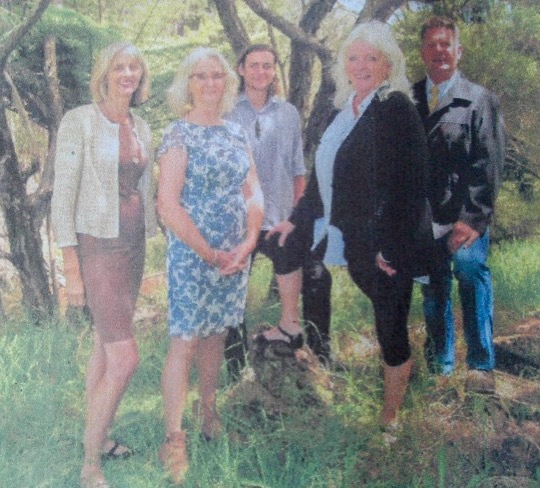 This board has significant delegated authority and a sizeable budget to work with, something many of us in Golden Bay tried for years to garner for our community board. What delegation were they finally permitted? They could drive around and name every insignificant culvert crossing in the Bay! Still makes my blood boil to think of all the forward-looking policies and practices that we and many others, including the group Golden Bay Futures, tried to achieve with no success. Through years of frustration and futility we had one victory: Council stopped using toxic landfill-destined plastic ring binders to hold their overbloated annual plan documents together.  Julia Sich, the herbalist who visited the island recently, wrote a blog of her four days with family friends who have lived for 30 years in Nagel Cove, an inlet on the northwest coast accessible only by boat. www.juliasedibleweeds.com/general/great-barrier-island-adventure/  I'll close with "our" oystercatcher pair, Rigg and Maggie, standing by while Joanna begins her swim. The south end of Medlands is the only "boat ramp" on the east side of the island. No worries, it's nothing like the scene at Tata Beach! 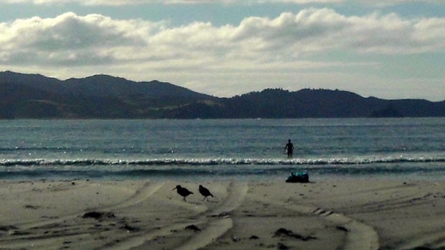
0 Comments
|
Great Barrier Island What am I doing here?
